

Last month we took advantage of a sunny fall day and drove the 4×4 pickup to the top of a ridge just south of Cle Elum, Washington.
Peoh Point is a rocky outcropping overlooking Cle Elum and Roslyn, both of which are nestled near I-90 in Washington state. The drive to Cle Elum along the freeway is fast. But the fast ends once you get off the paved road.

The drive to the parking area of Peoh Point is definitely for high clearance vehicles. We did not need 4×4 at all, but the potholes and rocks would have caused trouble for my car.
We found the Peoh Point hike through the Washington Trails Association site: http://wta.org . You can visit to read my report for our day of hiking here: https://www.wta.org/go-hiking/trip-reports/trip_report-2020-10-17-0055288474
Despite the slow ascent and very bumpy road, it was a beautifully crisp fall day with leaves full of color and drifting to the ground. Everything was damp due to recent rain, but snow was absent.
The “trail” begins about 10 miles up the unpaved road. Once you find the 5-way intersection of dirt roads, that is the place to park if you want a longer “hike” (or walk). Look closely, as I couldn’t count 5 roads so we missed this place. There is a sign which tells you to go left. We did. And parked just down the road.
The Peoh Point trail is really a cell tower access road, so the hiking was easy. Other than fallen branches, rocks, potholes, and puddles, it was a pretty relaxing hike. I’m glad we parked where we did though, to get a decent walk in. You can continue on the road to Peoh Point and get very close, about one mile, from the point. We wanted a longer walk.

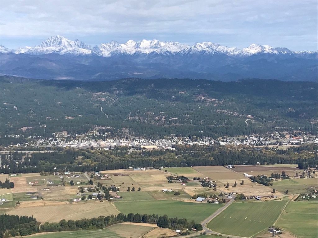
The point. Wow. We had views! The cell tower is ON the point, but there is plenty of space to wander around and look at the views. We could see (and hear) the traffic of I-90 and even a train. We used binoculars to find landmarks in Cle Elum and Roslyn. We could see Ronald, the lake, and more. We could tell eastbound traffic was backed up on the freeway. It was fun to play “bird” and see from a bird’s viewpoint.
BEWARE: Peoh Point is a cliff! Steep drop-offs are all along the north side of the cliff. There is a fence around the cell tower, but even with that fence, it would be easy for a pet or child to wander through. Most of the area does not have a fence, so take care around the edges.

Fun fact: At the 5-way intersection, there was a sign pointing to a different dirt road, one that said Ellensburg, 23 miles (or so). We want to go back some day and take that back road home. We just didn’t have enough time for 23 more miles of potholes. 🙂
This hike is gorgeous. Plenty of evergreens, deciduous trees, wildflowers, chipmunks, and birds. We mostly had the place to ourselves, other than one other couple and a few passing motorcycles and vehicles. We did not see any facilities.


November 10, 2020 at 7:07 pm
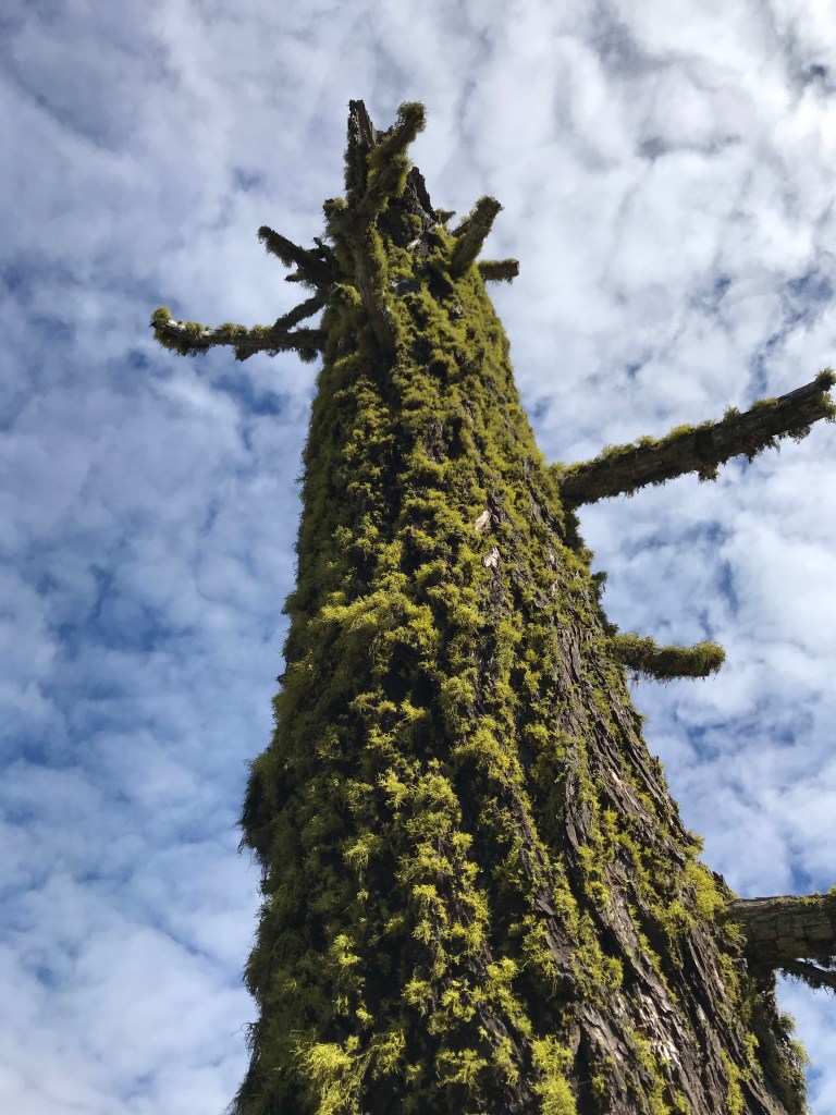
Angie, you captured so much beauty! I especially liked the moss covered dead tree and seeing the snowy mountains. Thank you for sharing.
LikeLiked by 1 person
November 11, 2020 at 12:22 am
Thanks so much, Gail. I was amazed at how crisp and beautiful the photos turned out. It was a lovely day.
LikeLike
November 16, 2020 at 3:07 pm
This sounds so beautiful! Love the way the mountains are just calmly watching over us all in the background. Hope I can get there to go on that walk some day.
LikeLiked by 1 person
November 16, 2020 at 5:15 pm
I’ll gladly take you. 🙂 It is beautiful!
LikeLike